
4Boats
Navionics EU004R Irish Sea Chart | 4Boats
Navionics EU004R Irish Sea Chart | 4Boats
Couldn't load pickup availability
Navionics+ EU004R Irish Sea
Premium High-Definition Marine Cartography
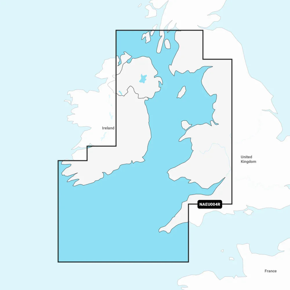
The Navionics+ EU004R provides comprehensive coastal coverage for the Irish Sea, offering the world's No. 1 choice in marine mapping. This all-in-one solution integrates detail-rich nautical charts with 0.5m (1') HD bathymetry, ensuring you have the most accurate data for navigation, fishing, and cruising.
Key Features
- ✔ SonarChart™ HD: 0.5m (1') HD bathymetry
- ✔ Dock-to-Dock: Advanced route guidance
- ✔ Daily Updates: 1 year of fresh data included
- ✔ Community Edits: Local knowledge & POIs
Technical Specs
| MPN: | EU004R |
| Region: | Irish Sea |
| Format: | microSD™ / SD™ |
| Bathymetry: | 0.5m (1') Contours |
Compatibility / Fitment Guide
| Brand | Series/Models | Notes |
|---|---|---|
| Raymarine | Axiom, Element, a/c/e/gS Series | Check firmware is up to date |
| Lowrance | HDS Live/Carbon/Gen3, Elite FS/Ti2, Hook Reveal | Supports microSD format |
| Simrad / B&G | NSS evo3, NSX, GO Series / Zeus, Vulcan | Fully compatible with microSD |
| Humminbird | SOLIX, HELIX 5/7/8/9/10/12 (G2 and newer) | Verify unit has SD slot |
Coverage Area Details
| Ireland Coast: From Fanad Head down to Kenmare Bay (Eastern Coast focus). |
| Great Britain Coast: From Port Ellen (Isle of Islay) down to Falmouth. |
| Key Ports: Londonderry, Belfast, Liverpool, Cardiff, Dublin, and Cork. |
| Islands: Detailed mapping for Isle of Man and Isles of Scilly. |
OEM Cross Reference
| Garmin Navionics+ Ref: | 010-C1232-20 / NSEU004R |
| Navionics Platinum+ Ref: | EU004R (L Size) |
| Garmin Vision+ Ref: | 010-C1232-00 / NVEU004R |
Questions & Answers
Is this a genuine original part?
Yes, this is a genuine Navionics (a Garmin brand) product, supplied in the official retail packaging on a microSD/SD card.
How do I know if it is compatible?
We recommend checking the SKU/MPN (EU004R) against your chartplotter's supported list. It is compatible with most modern Raymarine, Simrad, Lowrance, and B&G units.
Can I update this chart after I buy it?
Absolutely. Your purchase includes a 12-month subscription for daily updates. You can activate this via the Navionics Chart Installer software once you receive the card.
Note: Please verify your chartplotter model compatibility before purchase. For technical support, please contact 4boats.co.uk.
Share